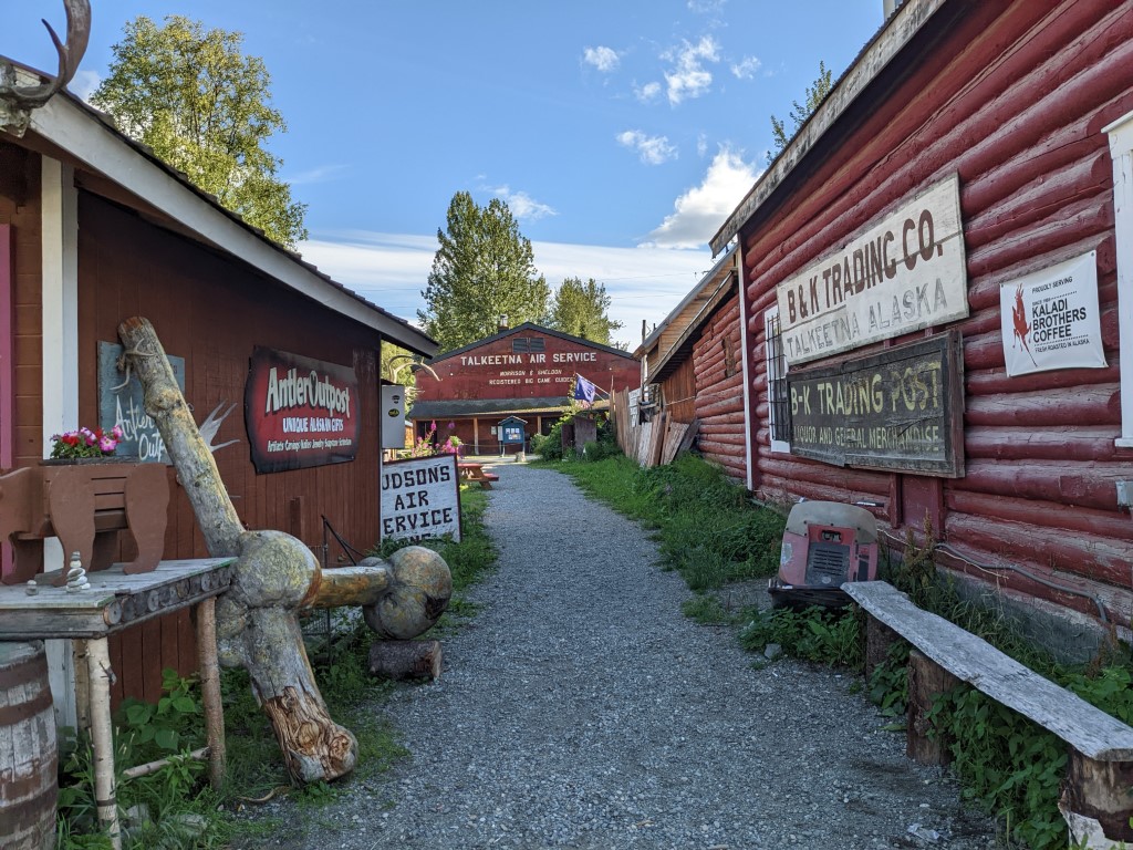
Well again, so much has happened since I’ve written anything here. I like it that way. It feels like we’re pushing the limits of summer even though it is only August. We only had 2 things booked ahead of time for this summer- one was Katmai and the other was 2 campgrounds at Denali National Park. So we headed off toward Denali and our reservations. On the way up there, we stopped 150 miles short to visit the little historic town of Talkeetna, originally a railroad construction camp, now a cruise ship excursion town, which changes the feel of it. It’s also the base for anyone wanting to climb Mt Denali, the tallest mountain in N. Amercia. In another life could we have done it? That tugged at me the whole time we were there.
Talkeetna is a popular place to flightsee from too but we haven’t done any of that. Partly it’s because our friends Mark & Anne have already introduced us to some great flying trips complete with airplane camping, hikes and big breakfasts so we don’t feel deprived. But what I had really wanted to do was fly in to the 8.4 million acre Gates of the Arctic National Park and then backpack out which isn’t uncommon, but logistically it’s harder to organize that. I guess it’s just as well because we have some large expenditures coming up for the truck such as a new entry door (maybe the 3rd one is the charm) and new seat cushions among other things. In some ways we feel like this trip was a bit of an intro to what you can do in Alaska and perhaps the next one someday can include more of those detailed itineraries. Like you can packraft and backpack through incredible wilderness if you have the right gear and the time to arrange it. There’s always more to do than time to do it. We’re working on the packraft idea.
Biking the Talkeetna mountain bike trails
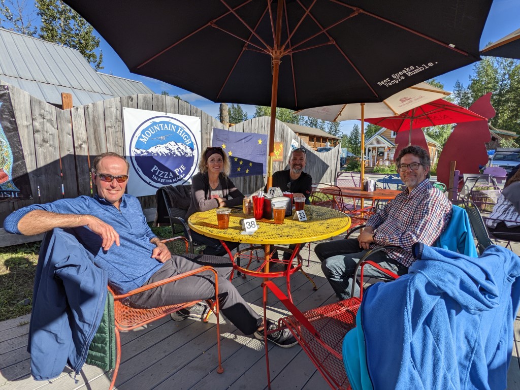
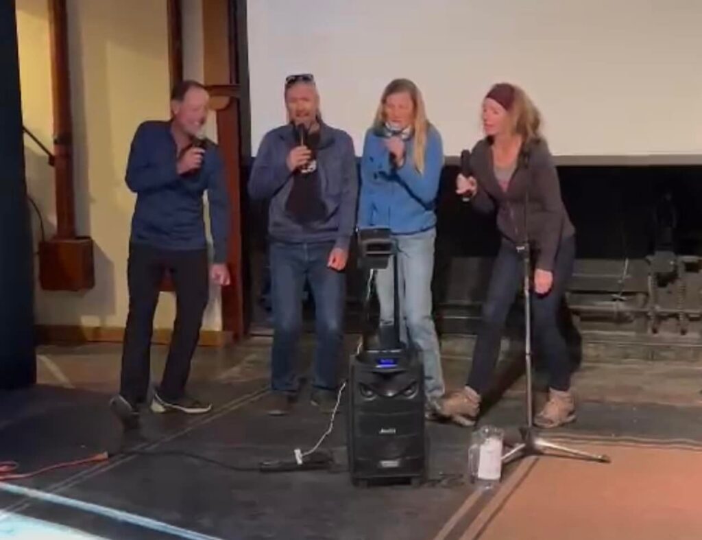
We met up with Sandie & Karsten and all parked up at the VFW since that’s the most centrally located campspot in Talkeetna. We had a night out on the town and at the restaurant, I ordered a fire hot pizza (spicy!) by accident which led me to very thirsty. Since there are no official waitstaff, every time you want a beer or anything, you have to go up to the counter to order & pay, then go back to your food and company. I like to check my own groceries but… While strolling back through town, we stumbled upon the community arts center and took a peek in there. Well turns out it was karaoke night and we offered to help them out with our lovely voices for a few songs. Our best one was Tainted Love. It was a small venue with lots of kids and I thought it was so funny how when they would finish a song, they had these plastic flowers that they would throw at the singer while everyone clapped. They forgot to do that with us! So anyway, stay tuned, it’s possible we might have been discovered that night by a scout and we’re about to become famous. Now that Ivan has a bicycle, we were all able to go out biking and Talkeetna has some great mountain bike paths so we had fun with that. All in all a cute enough town to stop at.
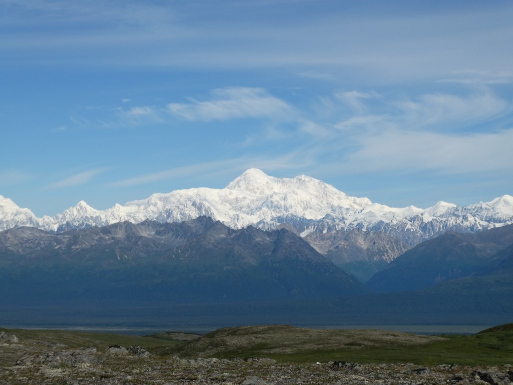
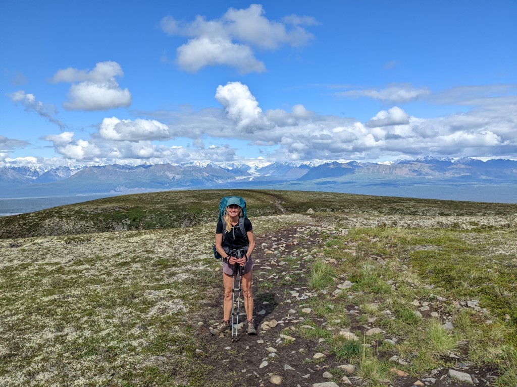
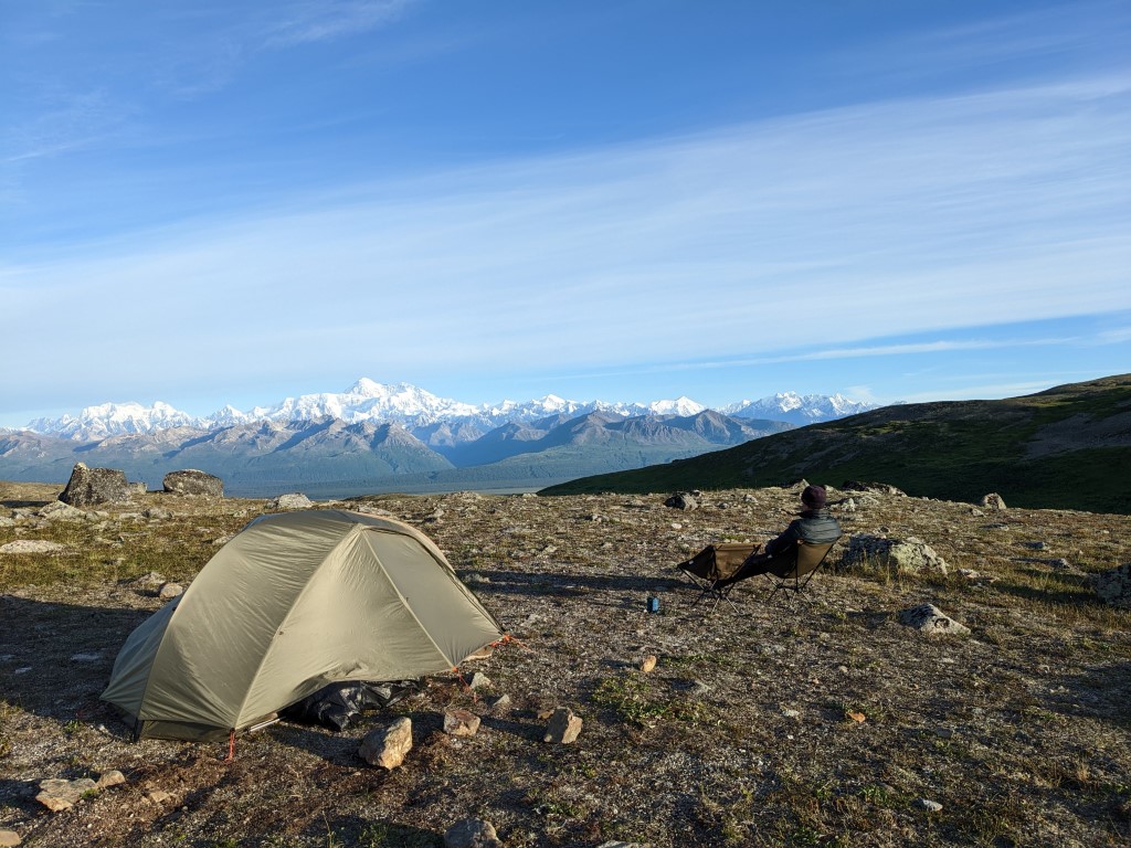
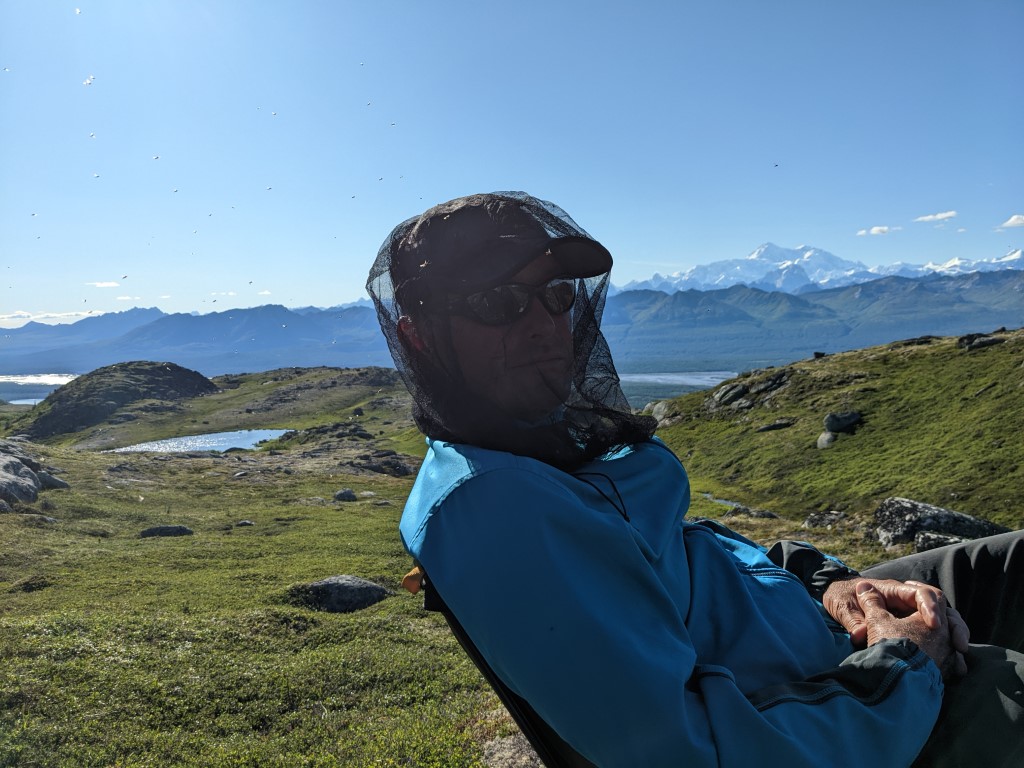
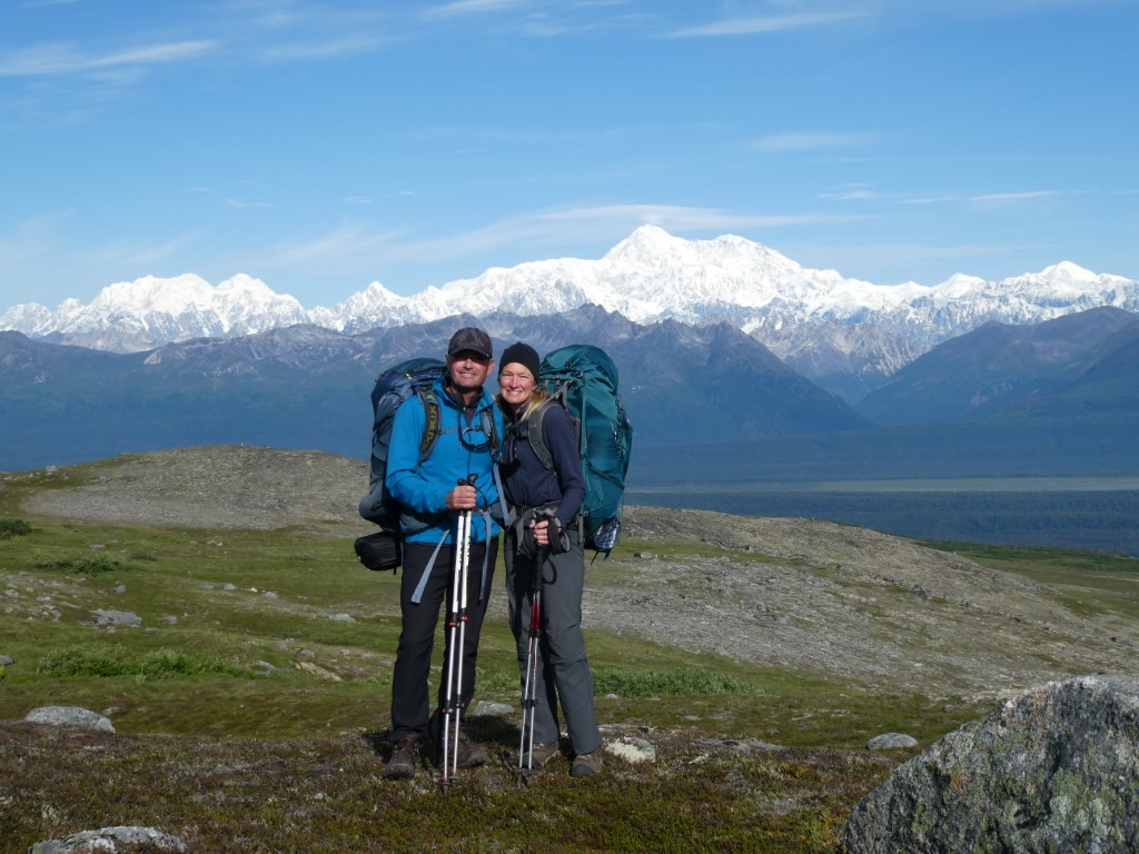
Jon & I had a backpack trip in mind for months now called Kesugi Ridge in Denali State Park. An alpine ridge that looks straight over to the Alaska Range, you can get the best views of Denali from there and for much of the 30 mile hike, you stay high which is sort of rare. The weather turned picture perfect so we jumped on the opportunity and did it. Since it was a point to point trail, we staged the motorbike which worked out well. It’s why we have it, although we don’t use it that often. I find backpacking addictive and its mainly the fact that you get up into incredibly beautiful scenery and then you don’t have to leave it. We encountered less than a dozen people over the 3 days and the views were splendid. Denali was out standing tall in the clear sky. It felt good to use our packs and to have a couple of quiet nights where you hear and see nothing but beautiful nature. Most of the time we had a breeze but on the second night it was still over dinner and we used our headnets for the first time since being in Alaska to ward off the bugs. But interestingly, we haven’t had a real big problem with biting bugs this summer. Sure, they’re around, but we haven’t found it to be a big deal at all and have barely used our spray. Did you know that mosquitos are pollinators? I didn’t. But I did know that they provide a food source for many a bird. There was a funny posting in the Deadhorse Camp dining room (the oil field work camp where we waited for a shuttle bus) with some factoids from some casual research calculations by a University of Alaska professor. It was a long explanantion but in short, he estimated that in all of Alaska, there are about 17 trillion mosquitos and if you translated that into weight, you would come out to about 96 million pounds of mosquito mass. The thought was it exceeded the weight of the caribou population which number about 950,000. But they don’t. Caribou weigh about 231 million pounds. So as you can see, the mosquitos aren’t that bad in Alaska! Haha. Who knows how much science is in the figures but it passed a few minutes and who would go to the effort to make this stuff up?
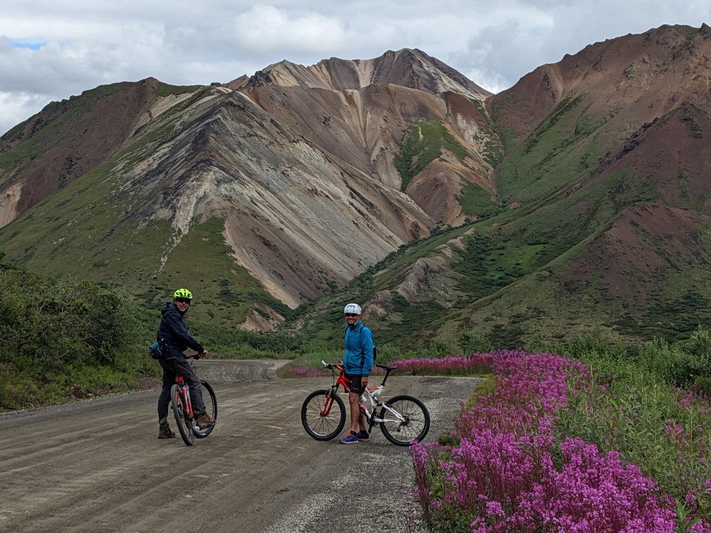
Biking the Denali park road 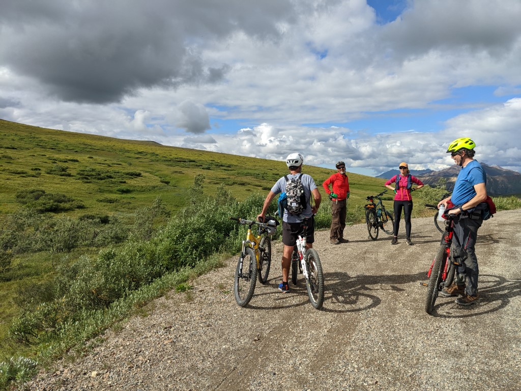
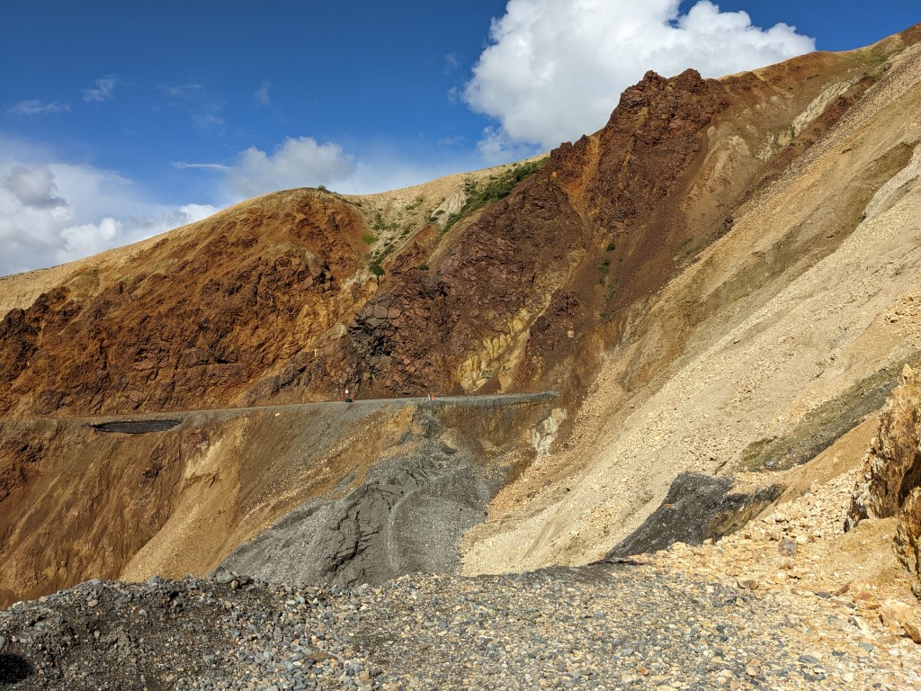
The Landslide area that disrupts the 92 mile road 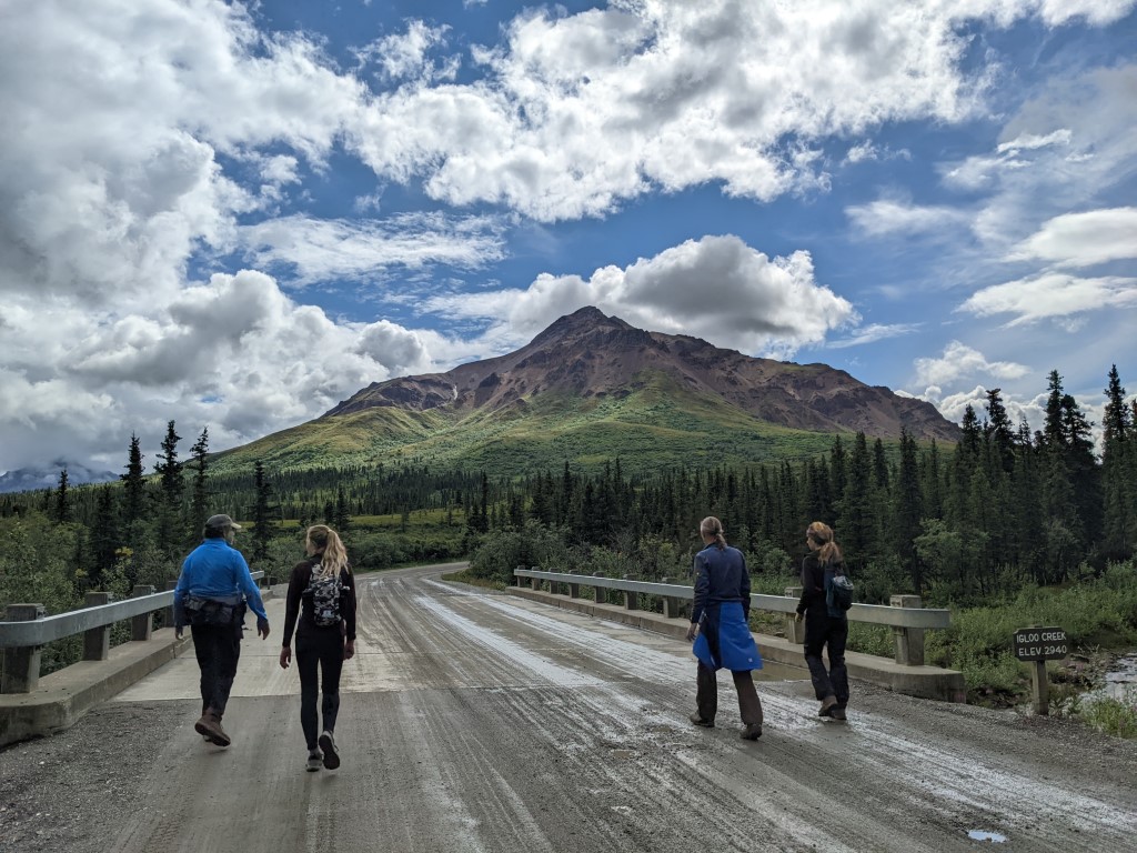
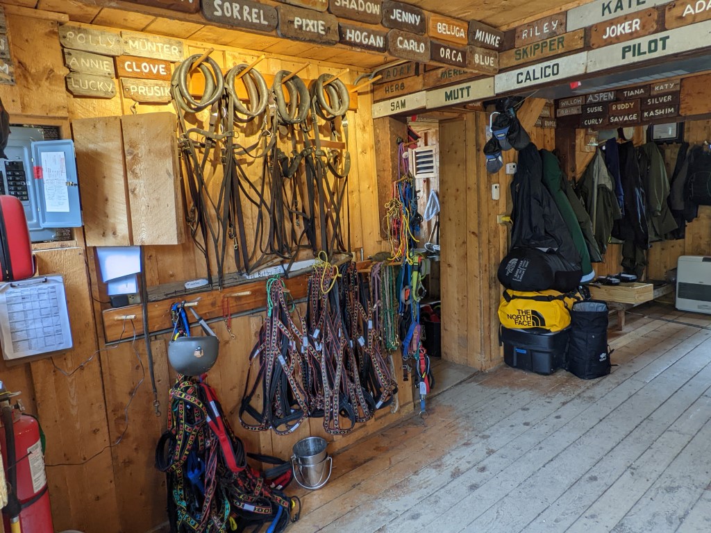
Gear room for Denali park’s sled dogs 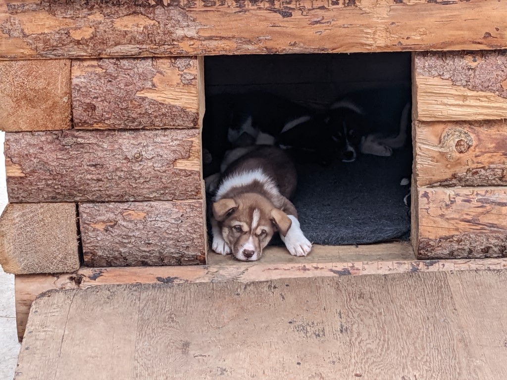
A sled dog to be 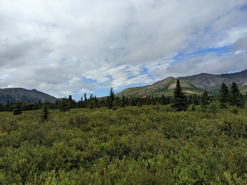
Lowland scenery at Denali 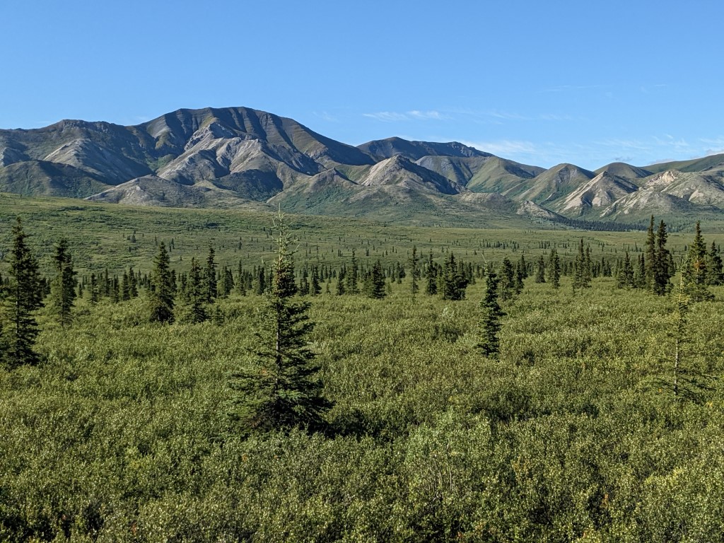
We spent a couple more days hiking around in Denali State Park and then the 5 of us moved in to the Teklanika campground in Denali National Park to begin our time there. We’d made these reservations back in January. It’s the farthest in campground that you can get to on the 92 mile park road now that the avalanche has closed half the route at mile 45. When we first decided to come to Alaska, we’d thought that bike packing the road would be great but quickly found out that the road closed somewhat permanently last August due to the Pretty Rocks Landslide. Everything we read online said that no one was allowed to pass so we aborted our plans and forgot about being able to do it. Then we get to the park visitor center and find out that indeed hikers & bikers ARE going past the slide area with permits as long as they know that they’re on their own. Arahhh! How frustrating. We quickly ordered up racks and paneers for our bikes and had them sent to friends in Fairbanks in hopes to be able to do this before we leave Alaska. Although the weather is looking less & less promising as the season progresses. We want it to be fun.
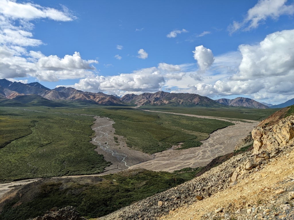
Anyway, the history of the Pretty Rocks Landslide is kind of interesting. What began as a little bit of movement every 2-3 years increased to the land sliding inches per year in 2014, followed by inches per month by 2017, then inches per week in 2018, inches per day in 2019 and then finally, .65 inches per hour in 2021! The road crew spread up to 100 truckloads of gravel every week to fill the slumping road until it was determined it was no longer feasible and they closed the road. I love that all that effort was for the park road to remain open for people to see. Impressive really.
We had decent weather to do some hiking together and one day we all biked about 30 miles return of the park road up to the landslide. It is amazing to contemplate 6 million acres of wilderness and park land. We love to look out over it and as far as the eye can see, there is nothing but natural scenery. The park buses can still drive this route but no private cars are permitted so it wasn’t too bad. Beautiful landscapes for sure. I think Denali is the only park that raises and uses sled dogs as working dogs which is the traditional way in the wilderness. We visited the kennels one day and listened to a ranger talk about them. I think that is one of the cooler ranger jobs to have. The next days the weather turned rainy and it really became hard to do anything significant outside, where we wanted to be. One night we made a big dinner of paella and Sandie made crepes. After our 5 nights of campground, we headed to Fairbanks where the weather was drier and we could have some civilization. And do a big pile of wet laundry.
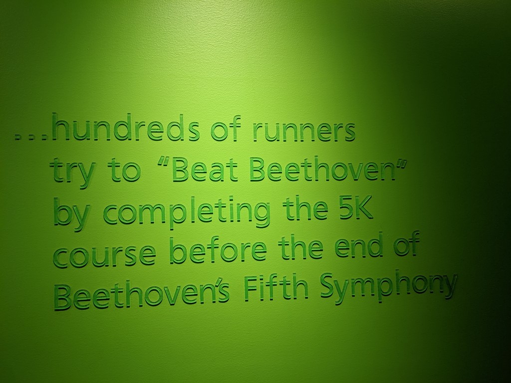
There is a themed race in Fairbanks each year… 
Went to a museum and learned a few things… 
Love the murals at the cultural center 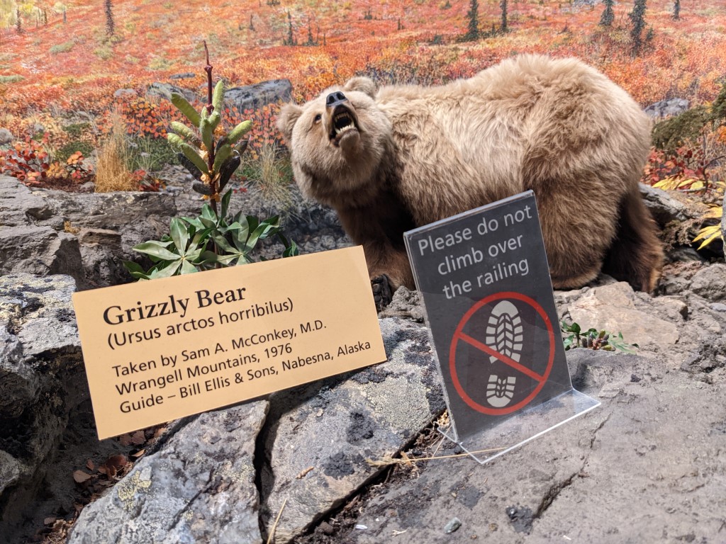
Look at the scientific name for a grizzly!
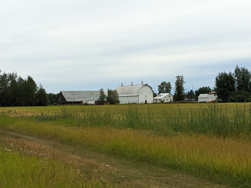
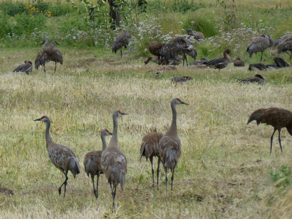
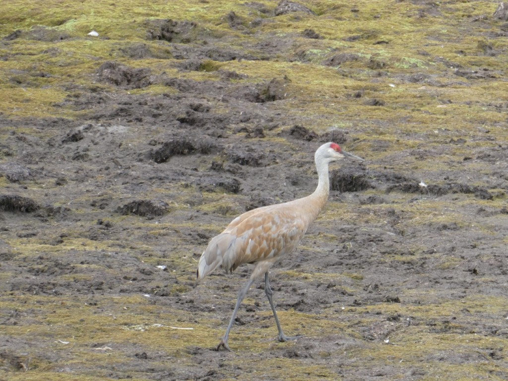
We like Fairbanks. It has better weather than many other parts of the state and there’s lots to do, plus the University of Alaska is there. We biked and ran their trails, went to the natural history museum, visited the cultural center and watched a film on the Brooks Range. Sandhill cranes summer in Fairbanks on an old, now preserved dairy farm called Creamer’s Field with large fields of grasses and wheat grown just for them! The seeds are subsidized by the local airport which helps keep the birds off their runway. Funny! It was a community effort to insure this farm was set aside as a preserve and the funding secured to do it. In late August, there will be over 1,000 cranes there getting fueled up for their migration to Florida. Who knows? Maybe the cranes that hang around Jon’s mom’s house are from Fairbanks, you never know…..
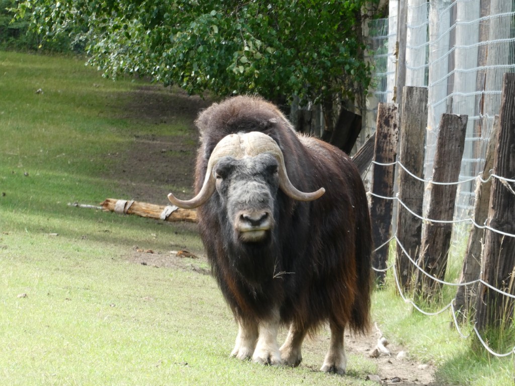
musk ox at the university research center 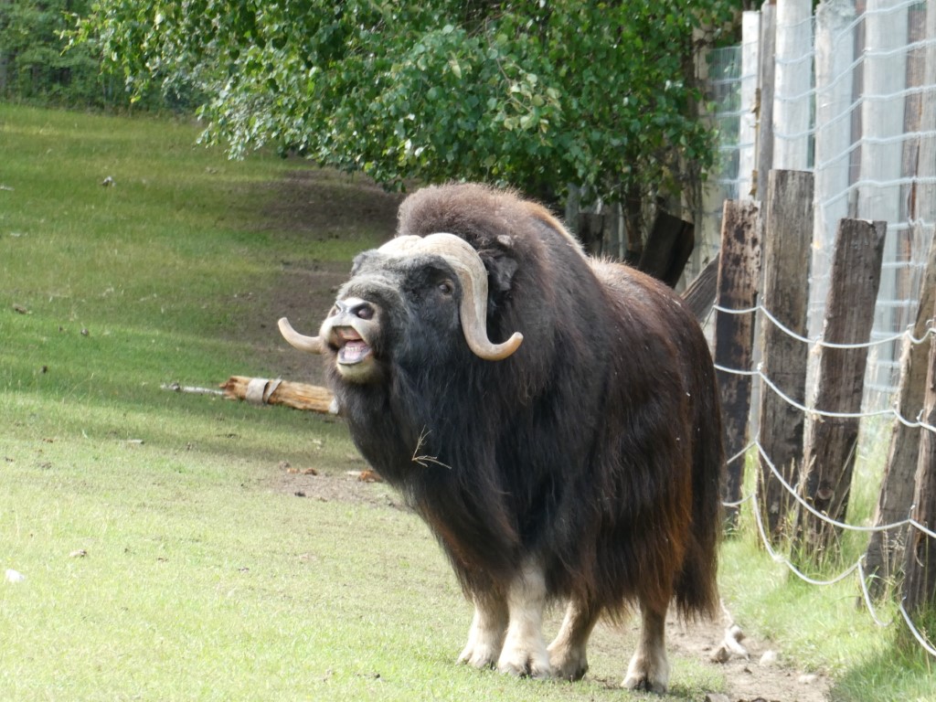
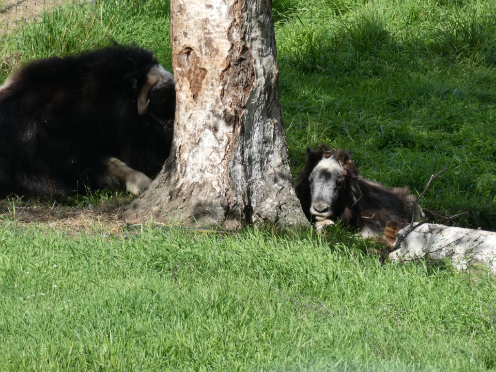
We also met up with friends Ed & Nikki who we met when we were staying at Kachemak Bay near Homer. It was a nice evening out with Thai food. I’m not exactly sure why, but Alaska is known for lots of Thai restaurants. On the day we biked, we stopped in to the university’s large animal research center where they keep musk ox, reindeer and a few bison. Musk ox primarily live on the North Slope and remain there all winter long uncovering grasses from under the snow, staying warm with their up to 2 feet length hair. While viewing them through the fence wondering why there was a massive tractor tire laying there, a male musk ox looked at us, then hauled off and rammed the tractor tire head on. I guess if not for the fence it would have been us!
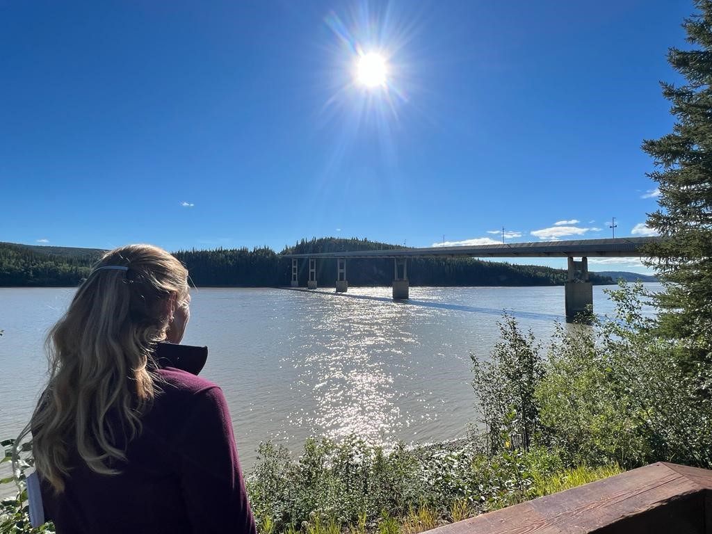
The bridge at the mighty Yukon River 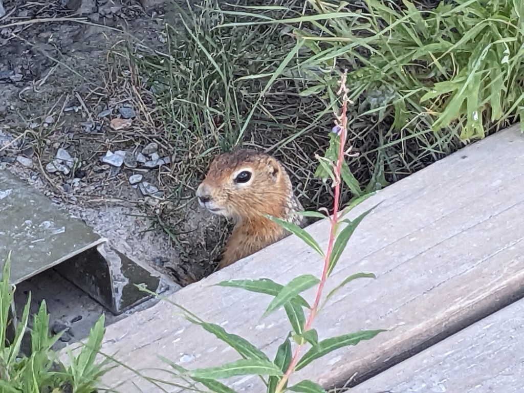
The skies were beautiful on the way up 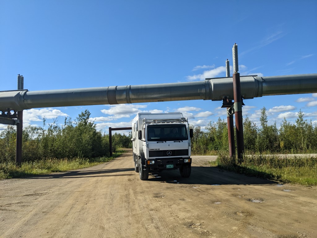
Going under the pipeline to get to the visitor center 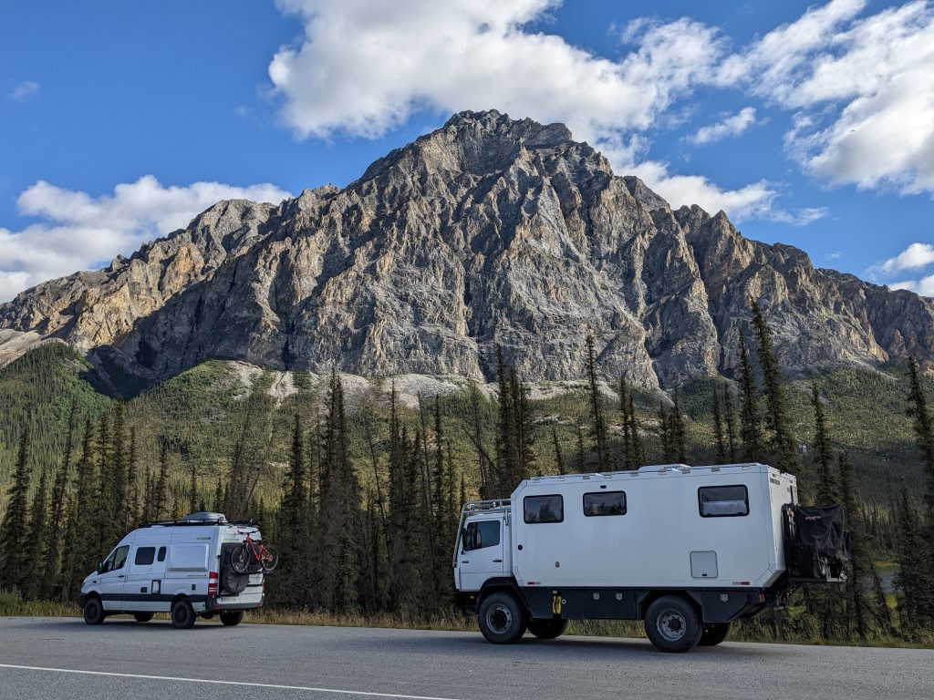
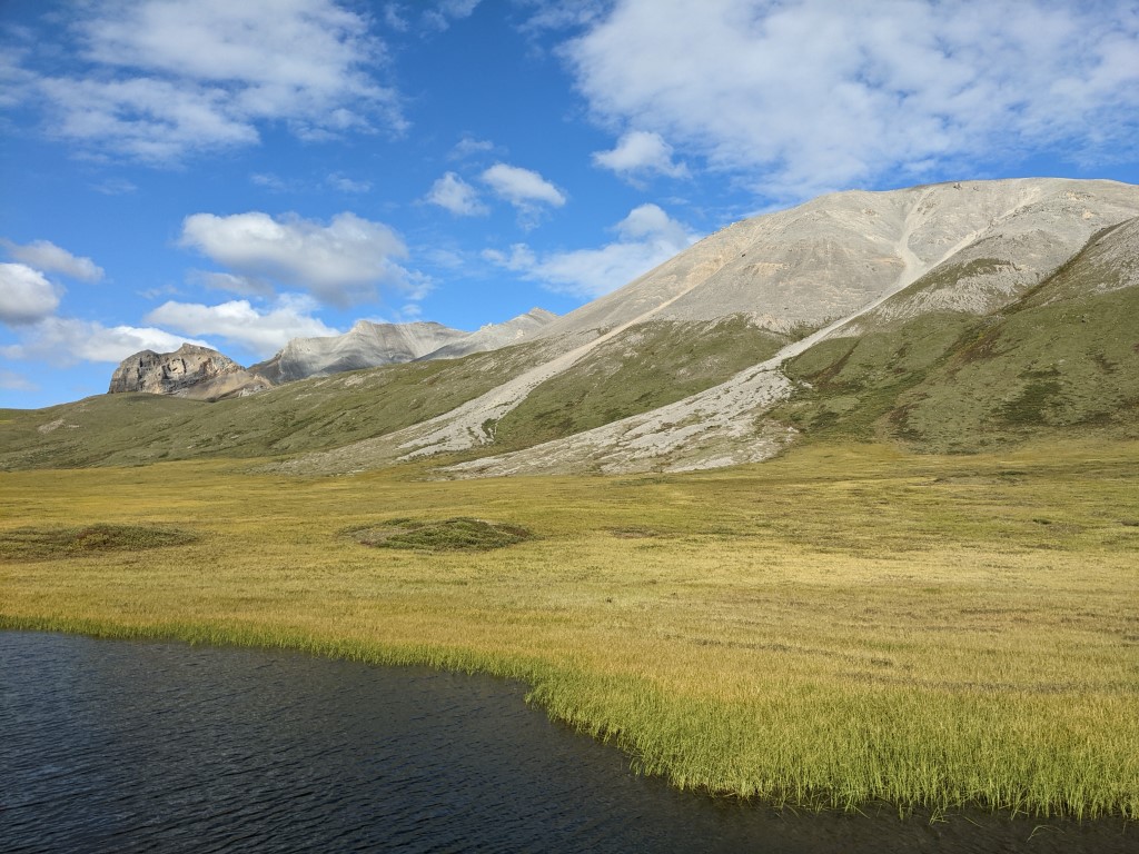
Brooks Range mountains 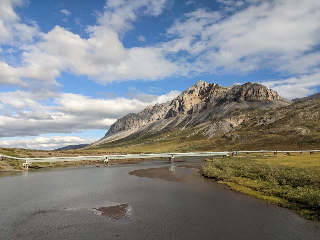
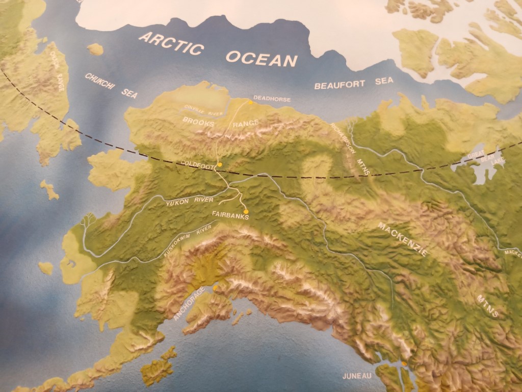
After a few days, it was decision time. Were we going to do the Dalton Highway to Deadhorse or not? The Dalton Highway is the 500 mile haul road that heads north from Fairbanks for the Alaska oil pipeline. This pipeline runs 800 miles from Prudhoe Bay at Deadhorse at the edge of the Arctic Ocean (Beautfort Sea to be exact) to Valdez. When oil was discovered on Alaska’s North Slope in 1968 and permission was granted to drill and pipe it, the road was built in 5 months and then the pipeline in 3 years 1974-77. Considered an engineering achievement because of all the obstacles they faced, it is still going strong even though it has outlasted its intended lifespan. Initially a private road, it was later turned over to the state and renamed the Dalton. In 1994, it was opened up to the public so that adventurous souls could travel all the way from Fairbanks to Prudhoe Bay if they wanted.
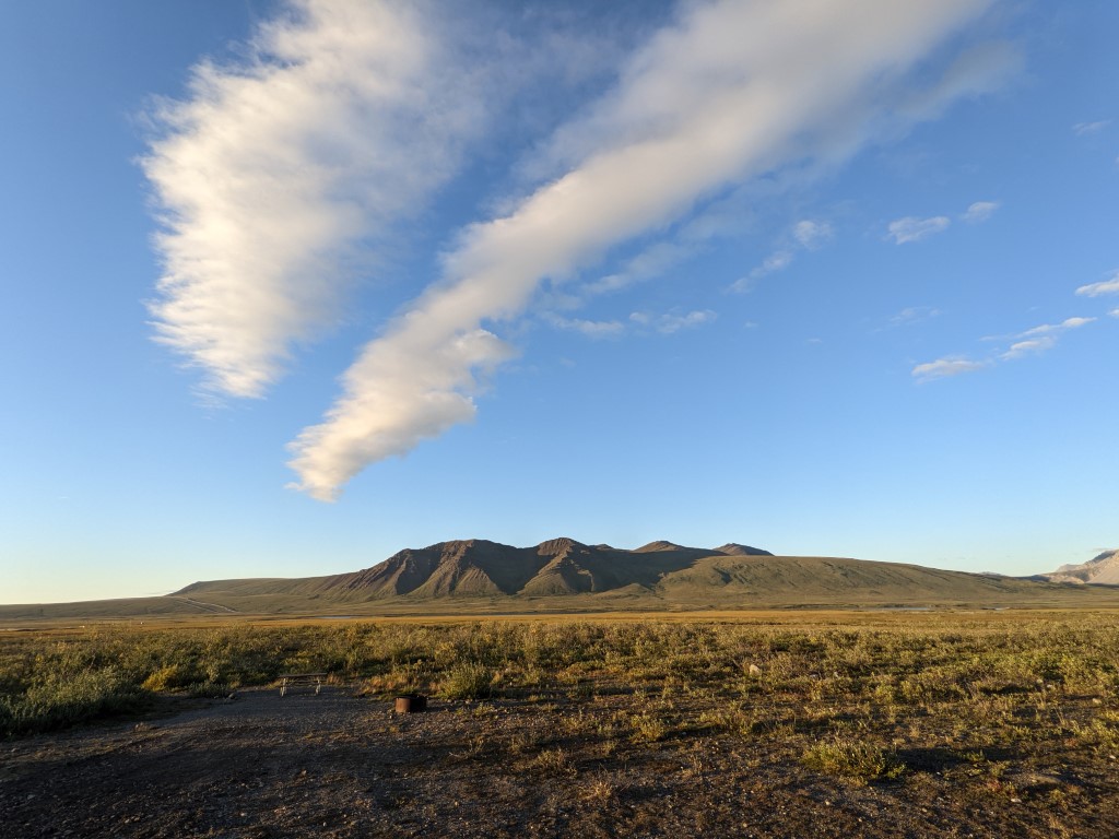
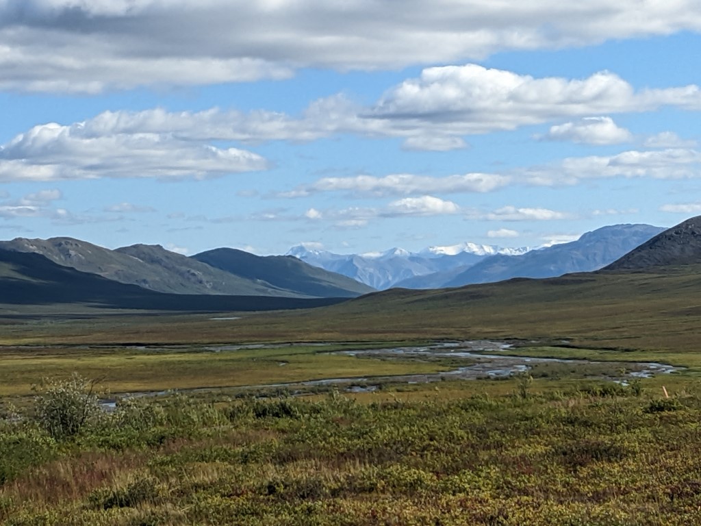
After some research, and with a great initial forecast, the three of us decided to go for it. Even if we drove only as far as the Arctic Circle, it would be something. We’re so glad we did. The road is part dirt, part paved but in relatively good shape. It covers incredibly beautiful, remote scenery, including the Brooks Mountain chain which gives way to the treeless, rolling alpine hills of the North Slope. There is a 5 mile corridor where the road and pipeline run that is overseen by BLM but the road is maintained by the state. The surrounding that land is NWF, NPS and state land. Home of grizzlies, musk ox, caribou (all we saw) polar bears, (sadly we cannot see these because of continued covid restrictions) and lots of pretty tundra. The road runs along the pipeline but the infrastructure is sparse and we would say carefully done so as not to disturb any more of the tundra than necessary. If it weren’t for the pipeline, there would be no road and no way to see the land that goes as far north as one can go except by small plane. When you look at the pipeline you can’t help but think of all the effort, detail and science in it and we know it is a very significant part of Alaska’s history, probably only second to the gold rush. Very few people live in these parts. The Arctic Circle is simply the southermost point where the sun doesn’t set in summer nor rise in winter. Any point further into the circle means more complete days of sun or darkness depending on the season. Unlike the north slope, you can’t really appreciate the line if not for the sign. But there’s no missing the last tree growing before the tundra takes over or the majestic Brooks Mountains rising up in the distance.
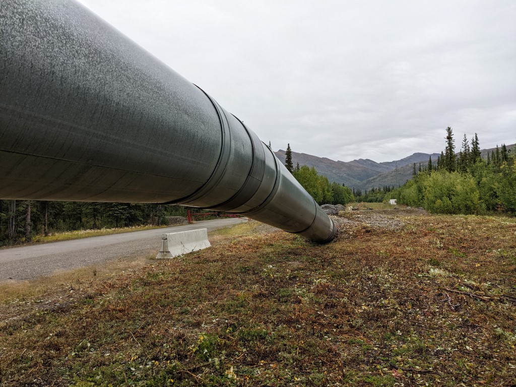
Sometimes the pipeline runs underground 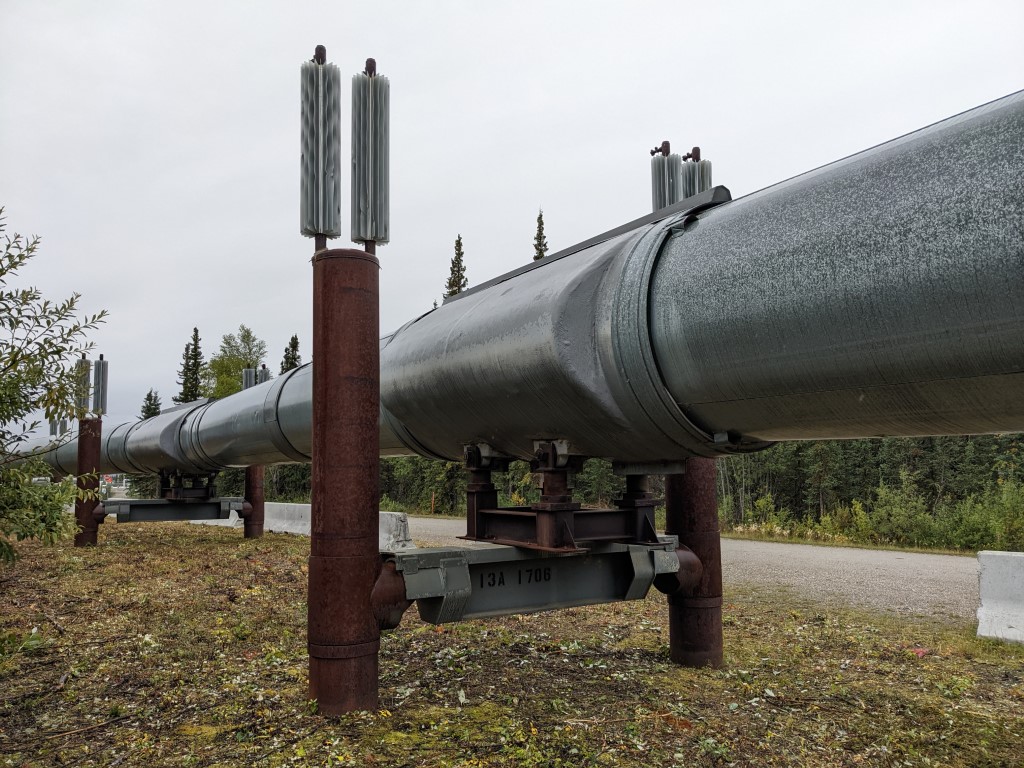
Close-up of the pipeline. It is made to move around with earthquakes and permafrost and tolerate forest fires 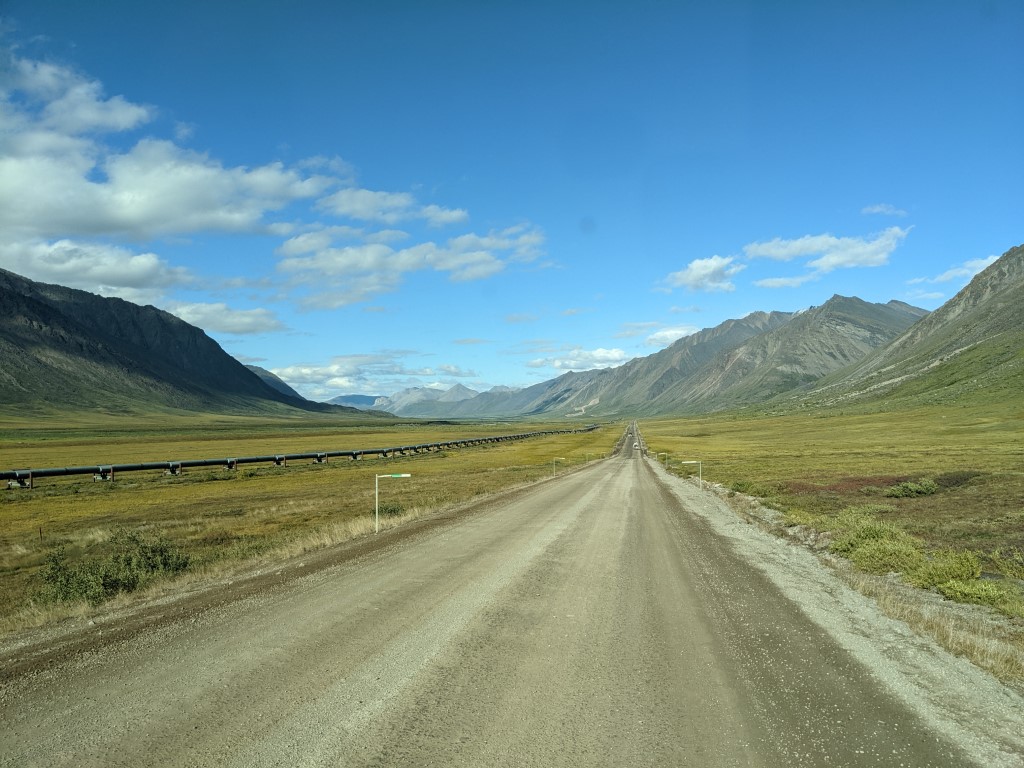
Pipeline running along the road
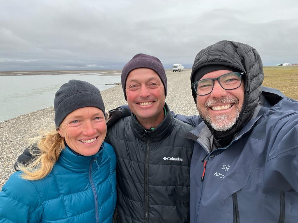
When we saw that the weather was to be 70 and sunny for one last day, we picked up our pace so we could get to Prudhoe Bay in time for that day. The 3 day drive was gorgeous. We stopped at many beautiful viewpoints, strolled some trails, walked through the tundra, ate at a truckstop (yuck), visited the excellent visitor center in Coldfoot, explored the tiny little “town” of Wiseman and found that the dirt is a lot smoother to drive on than the bumpy pavement. We are thankful for the upgraded suspension. Even so, my neck got sore from the permafrost heaves on the pavement sections.
Oil stuff 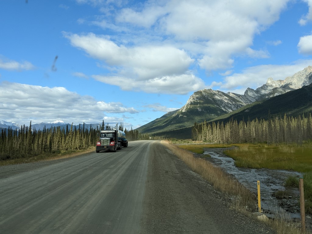
Trucks on the Dalton Hwy 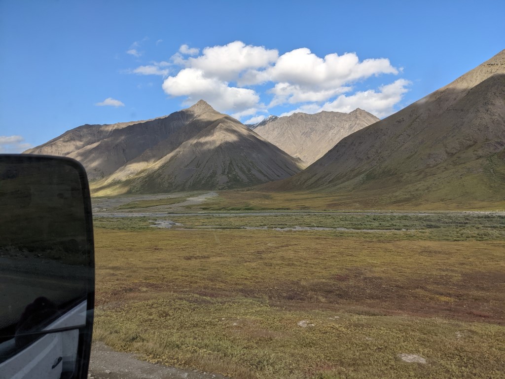
Brooks Mountains 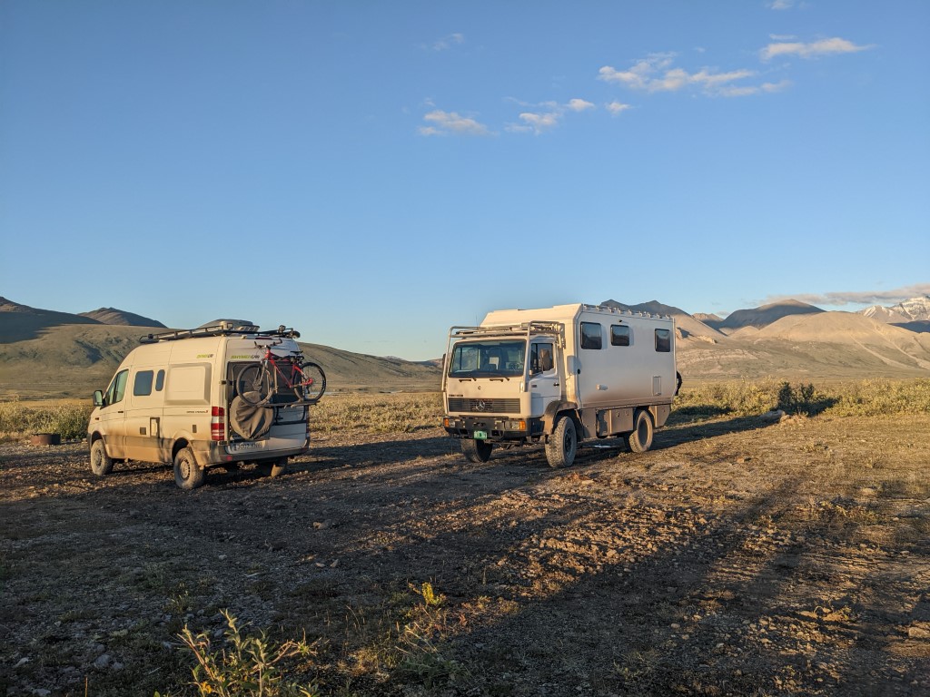
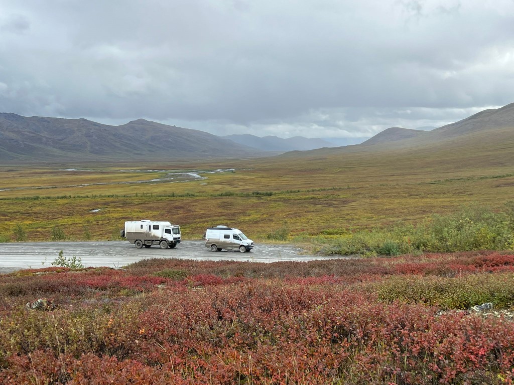
There were beautiful BLM campgrounds on the way 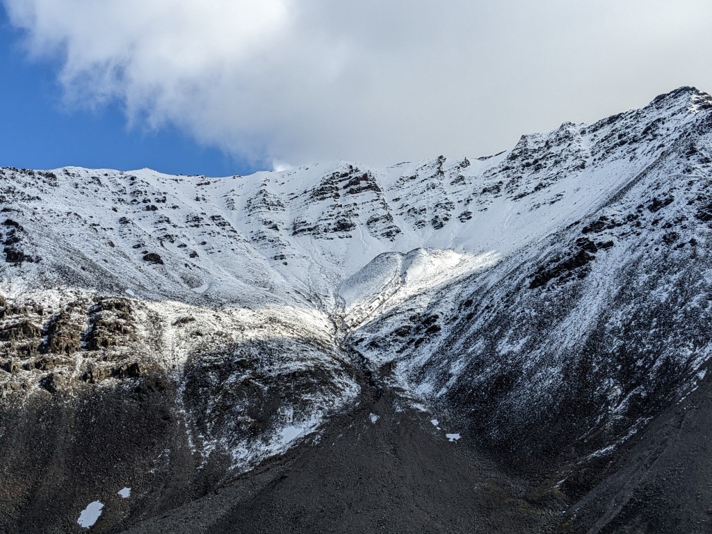
Atigun pass area had gotten some snow 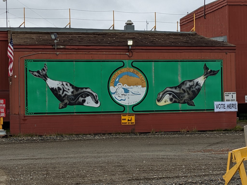
The governing center of Deadhorse 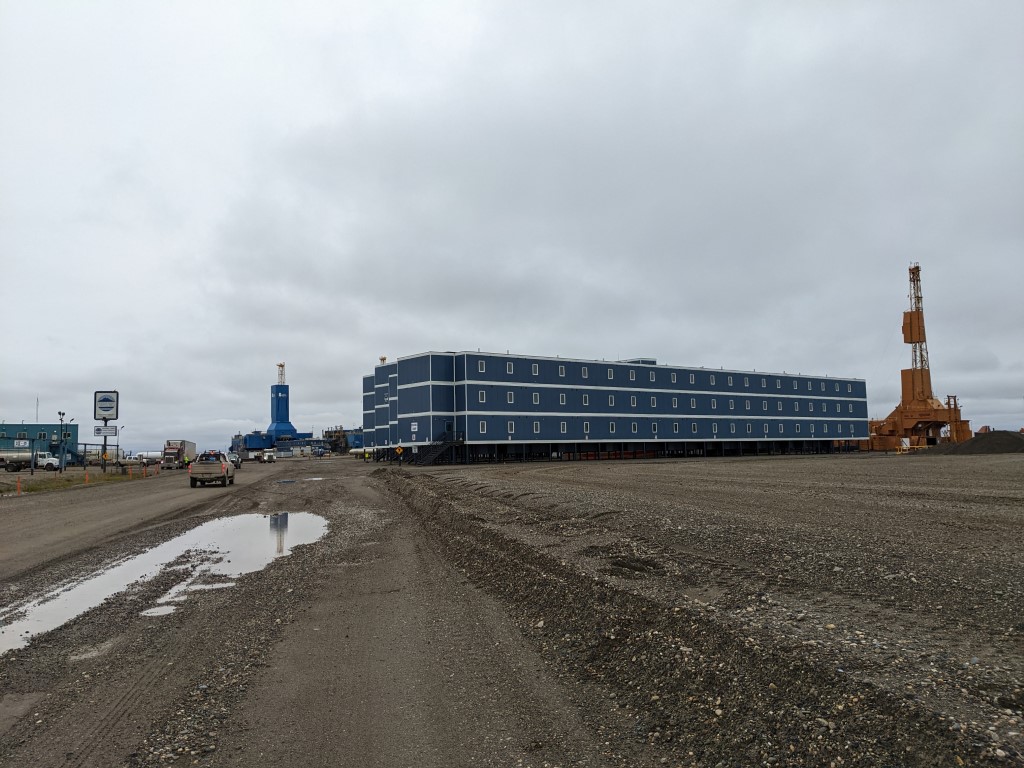
A work camp building 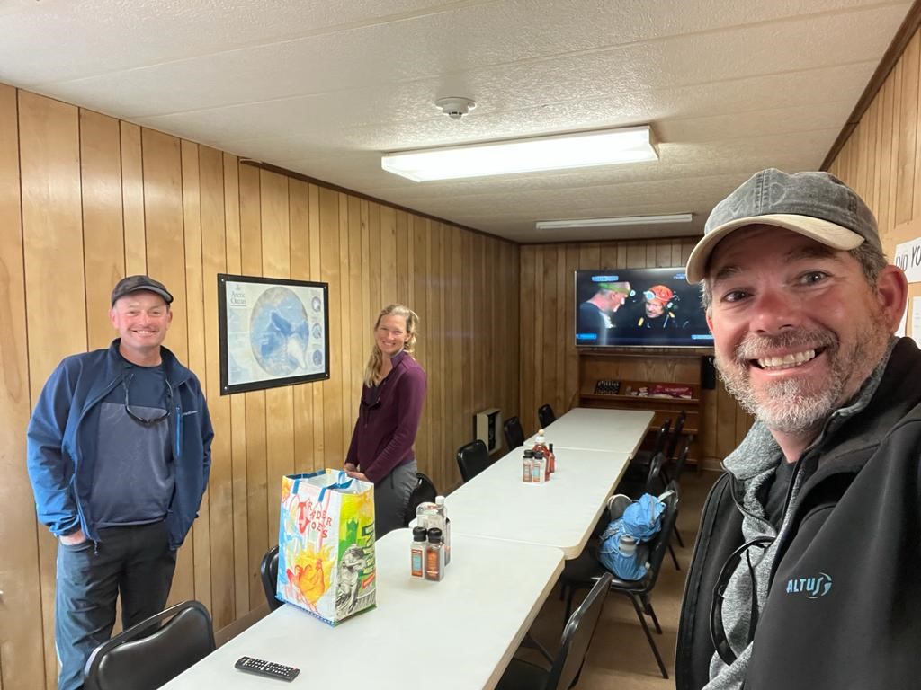
In the dorm cafeteria waiting for the shuttle 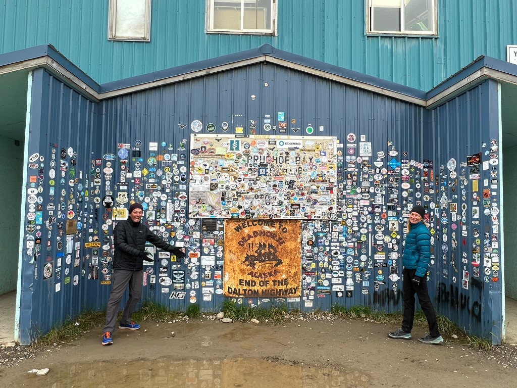
The overlanders wall in Deadhorse 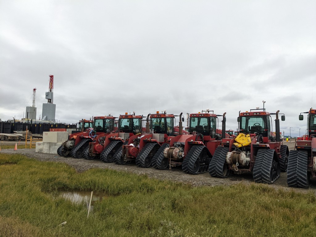
Lots of fun looking winter equipment
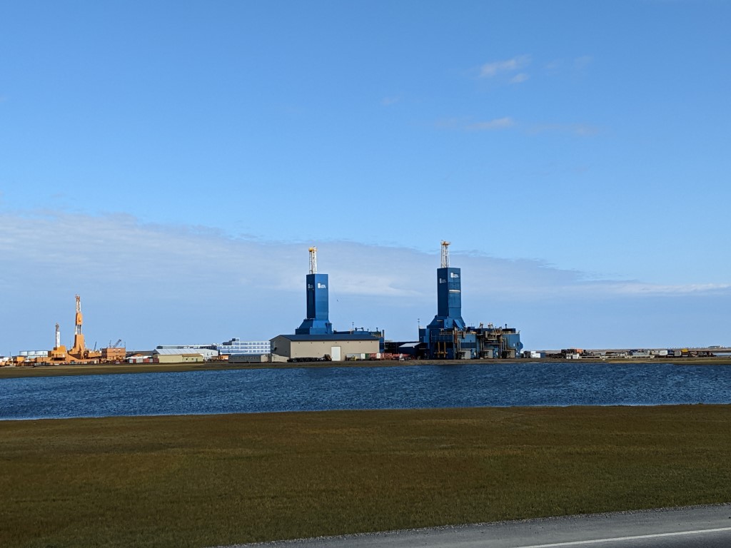
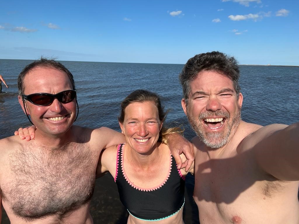
When you get to the oilfield at Prudhoe Bay, you need to take a shuttle bus the last 8 miles in order to see and swim in the Arctic Ocean. Originally a turnoff, we embraced it in the end because we got to 70 degrees north which we’d never seen before, the North Slope is lonely and wild and the oilfields are interesting in their own right. We learned a few things on the shuttle bus tour. There are about 800 separate platforms over a 500 square mile land area. Currently employing about 3,000 men, it can swell to 10,000. Winter is the busiest time. Workers do 3 weeks on and 3 off. In the winter, they make ice roads in order to move their equipment over the tundra with less damage. The sheer magnitude of the infrastructure and the “machine” of it all was impressive. All of the heavy equipment, the massive portable housing units and the way that they move these board by board over the ice. It is one huge, dry, work camp and nothing else. If you stay in a hotel there, it is just a worker’s room because he is off on his break. But of course we had our campers and they are luxurious by comparison. Then there are the birds. Birds come from 6 continents to summer up there. Then in the Fall, they migrate huge distances to get out of the cold. The Bar-tailed Godwit flies direct from Alaska to New Zealand without resting taking about a week for the 7,000 mile journey.
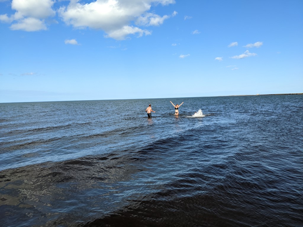
One two three dunk! 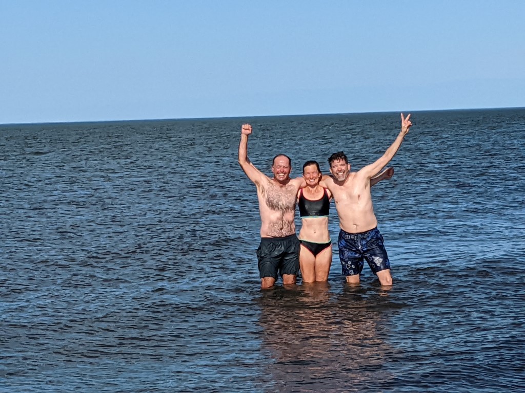
Looking at the pack ice 
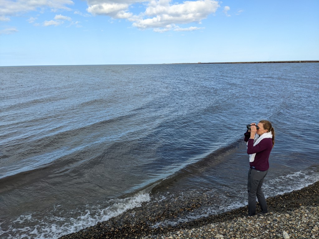
Swimming in the Arctic? Not our coldest by any means because Prudhoe Bay is quite shallow as it sits on a shelf and not the most beautiful water either because it wasn’t that clear. But still! The shuttle driver loaned me her binoculars so I could see the pack ice in the distance. Great to get in and know what this part of the world feels and looks like. We love to travel this way and to be sharing it with Ivan who is a lot of fun and takes great selfies. 70 degrees of latitude and 70 degrees temp! It was a great day.
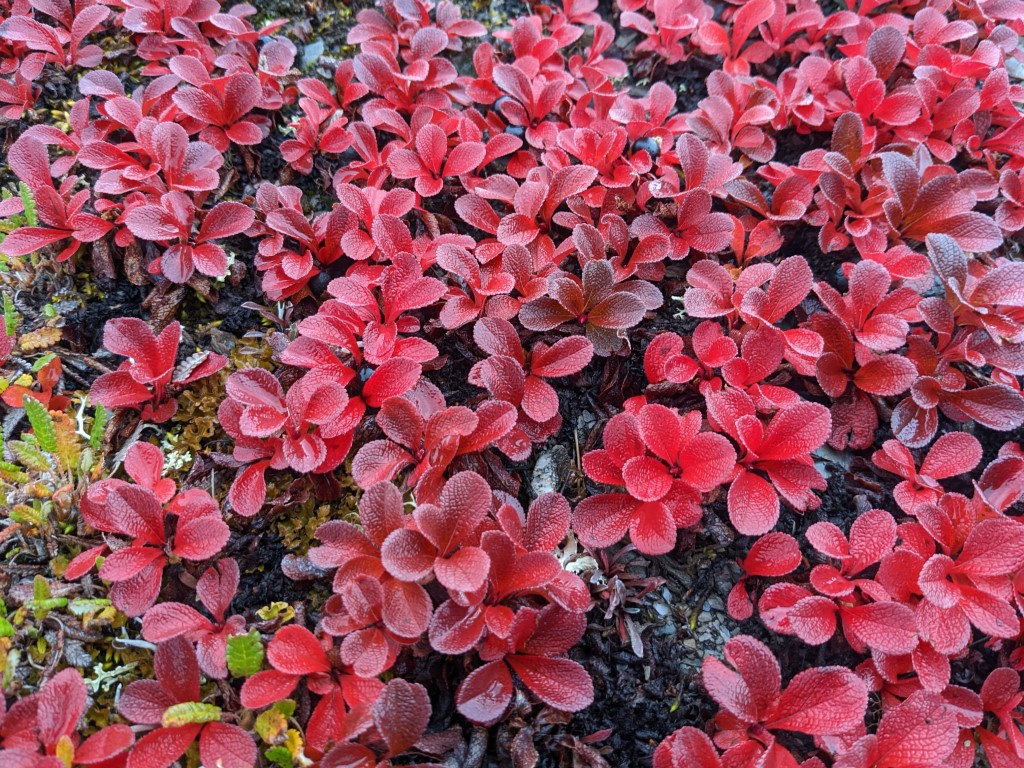
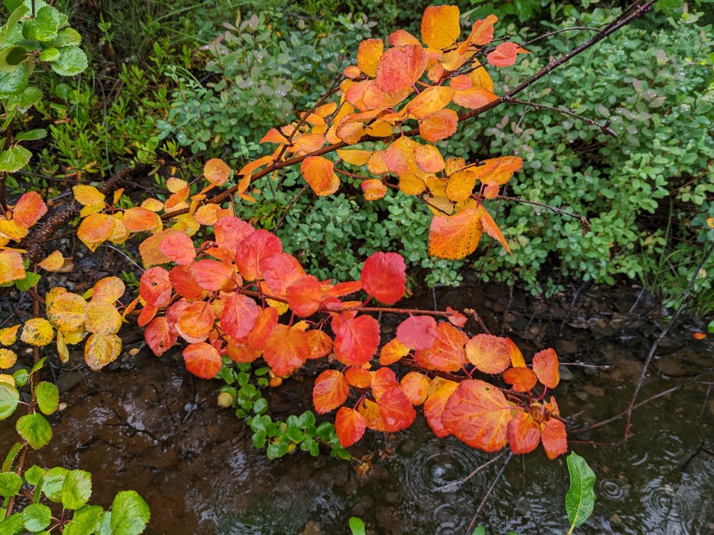
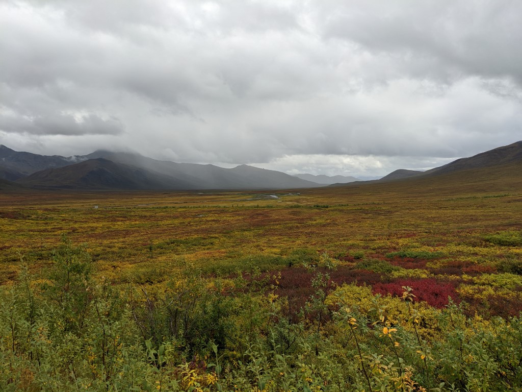
The color change was rapid, over 48 hours everything was different 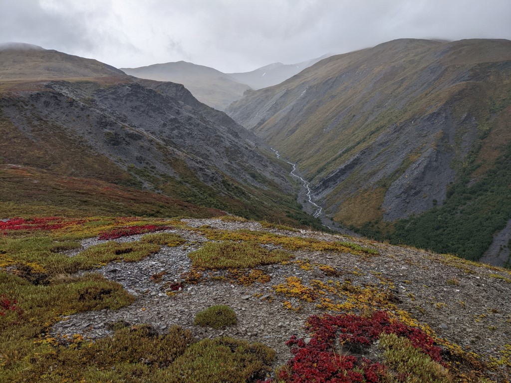
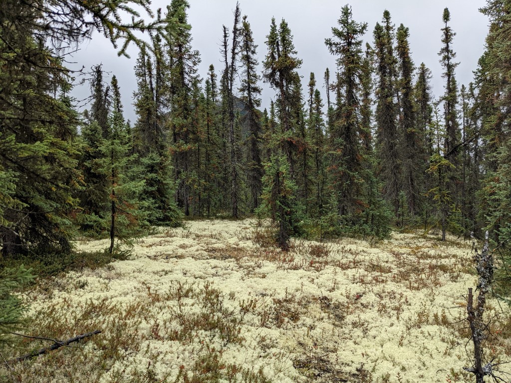
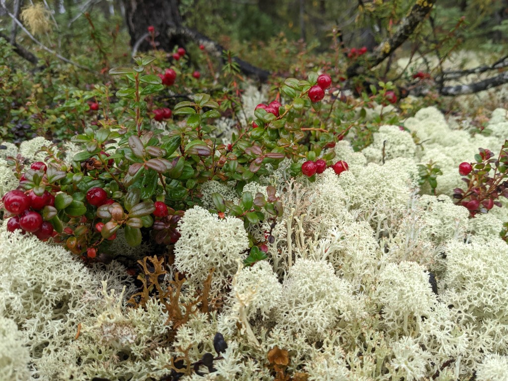
Caribou love these lichens and we do too 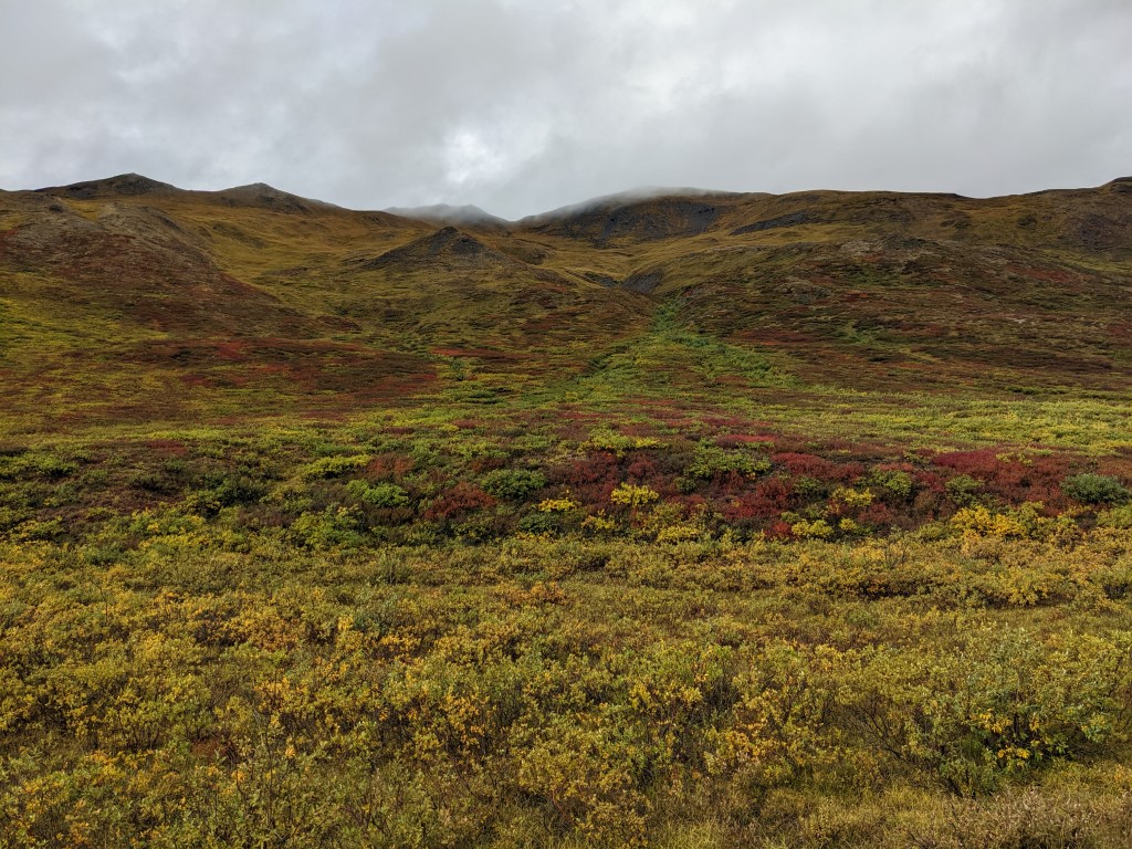
Tundra views 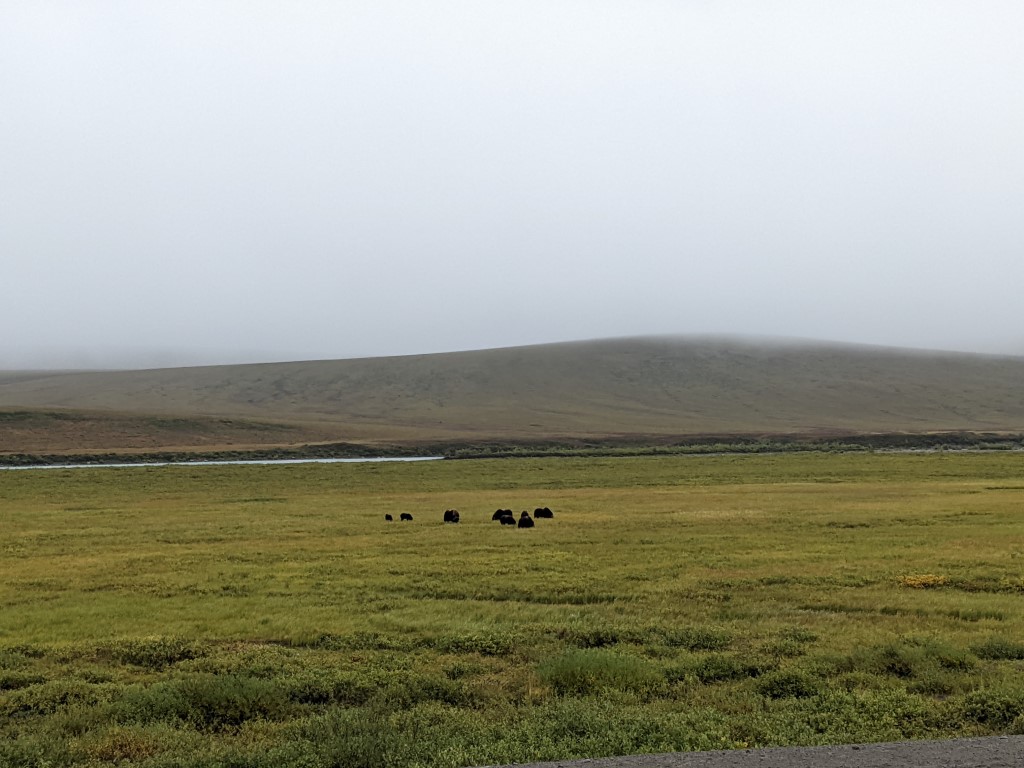
Musk ox in the fields on the North Slope 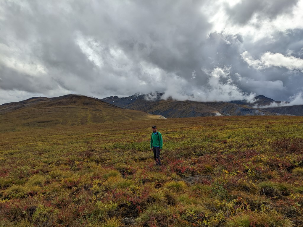
This was right before it started to pour.. again! 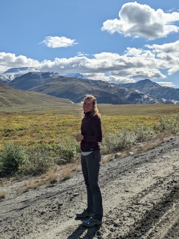
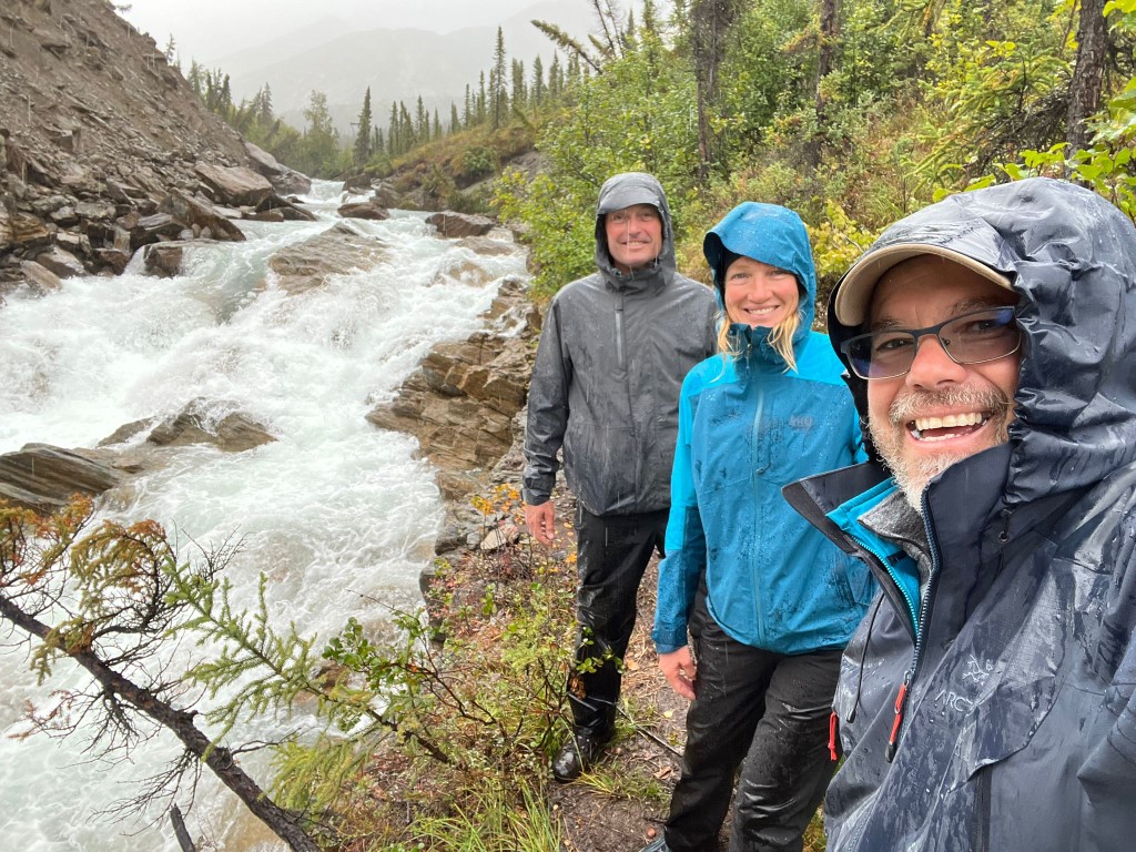
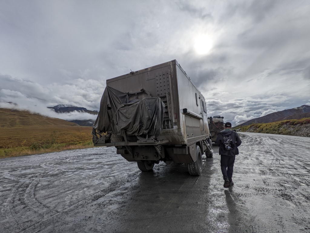
The next morning dawned in the 30’s as forecast and gray. What a temperature change! We walked the oil “town” and then started making our way south again on the road. We couldn’t see as far, the rain turned the road to a mudbath and our trucks became disgustingly dirty. There are a lot of trucks on the road and we found them to be really polite although we always cringed when they went by hoping a big rock didn’t chip our new windshield. We learned at a ranger talk that they put calcium chloride on the roads to help them solidify which works great until it rains and then they turn muddy and kind of slippery. It reminded me of how our boat would get caked in salt on passage and you felt like you could bottle up a case of sea salt in a few minutes. And that you’d never get it off again. But unlike a passage where you feel a little beat up and uncomfortable by the time you arrive, in the truck it’s pretty easy, well except for my neck. It’s an adventure, but it isn’t really adventurous we’d say. Unless, you are doing it the way we saw a few adventurous souls doing the Dalton…. by BIKE or on foot! We saw several bikers and even one guy pushing a cart with his belongings and his pet dog beside him. Rumor has it he started in Ushuaia. Amazing. I envied them on the sunny day and then thanked my lucky stars I was in my truck on the rainy mud bath days. We crossed paths with Sandie & Karsten who were heading up for their own little swim, at their own pace.
One really interesting thing is that in those 48 hours from us going northward to heading southward over the miles, the tundra had changed color from greenish yellow to the reds and oranges of fall. Incredible! So it really IS fall!
We’re now back in Fairbanks. We got together with Cathy and Pato again tonight which is always fun.
$25 at the carwash wasn’t enough to get all the mud off! 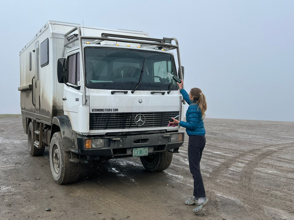
It’s time to make like snow birds and head south! I’ll let the pictures do the rest of the talking.